
DLINGO, BANTUL · YOGYAKARTA
Wait for the city to light up between the pines.
A hillside field guide for a slower visit through pines, hand-built timber forms and a far-reaching view over Yogyakarta.
Begin the guide↓07°52'16.3"S110°27'25.0"E
Public reference photograph · copyright remains with the photographer
PINE LANDSCAPE & LOOKOUT
More than a photo backdrop.
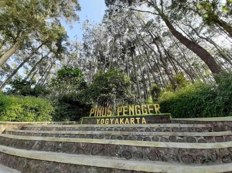
Pinus Pengger sits in the Dlingo hills, where a pine landscape meets branch-and-timber installations. Its pace is shaped by short paths, changing weather and the city view beyond the trees.
Bantul’s public potential map lists the site in Dlingo’s cultural and tourism sector. This independent guide is for preparation, not an operational notice.
PLACE, MEMORY & EVIDENCE
A forest with more than one chapter.
Professional interpretation separates what is documented from what is merely repeated. Pinus Pengger’s story is best read through the landscape, the neighbouring villages and the community-built visitor experience—not through unverified folklore.
The wider Dlingo pine belt
Kalurahan Terong identifies Pinus Pengger as one of several pine destinations in Kapanewon Dlingo, alongside Mangunan, Becici and Pinus Asri. This helps place the site within a broader upland landscape rather than as an isolated attraction.
From working forest to visitor space
Public travel writing describes a transition from pine-resin production to an ecotourism-oriented visitor site. Because this account is not an official historical archive, it is presented here as context and should not be read as a definitive institutional history.
Crafted viewing structures
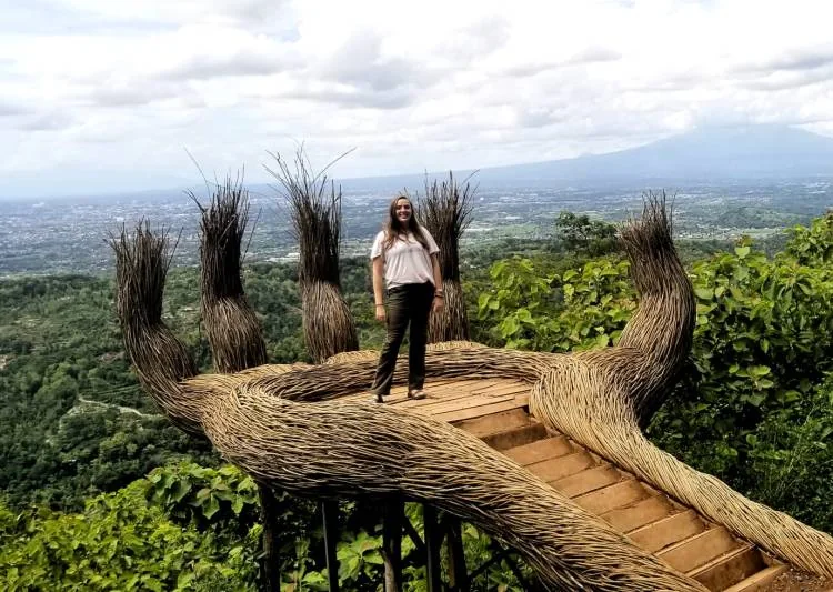
The village and district sources document timber and branch installations, viewpoints, camping and activity spaces. These works are part of a locally shaped visitor environment; do not climb, modify or cross barriers around them.
No invented legend
This guide has not found a citable public source for a specific local legend tied to the site. Rather than turn hearsay into heritage, it leaves oral history open for community-sourced documentation.
THREE WAYS TO READ THE SITE
Follow the light.
Respect the slope.
01
Hillside panorama
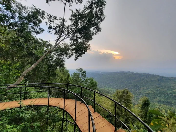
On clearer days, the ridge opens onto the valley and the city below. Cloud, haze and the season determine what can actually be seen.
02
↘Timber installations
Hand-like, framed, circular and bridge forms act as visitor landmarks. Queue patiently and follow safety instruction at each structure.
03
A quieter pocket
Between the viewpoints, seek the shaded paths and pause without blocking circulation or disturbing other visitors.
VISIT WITH CARE
Arrive with a simple plan.
Best window
Morning can offer softer light and a more measured pace; the city lights draw visitors later in the day. Choose around weather and a safe return journey.
Time on site
Allow about 1–2 hours for gentle walking, selected photo points and breaks. Leave a margin if you arrive at a busier time.
Footing & weather
The terrain has contours and can become slippery. Wear shoes with grip, carry water and stay inside the marked platform boundaries.
PRACTICAL FIELD NOTES
Before the wheels touch red earth.
ENTRY REFERENCEAround
Rp5,000
Rp5,000
Bantul’s public potential map gives this as an indication. Confirm all charges on arrival.
+ Vehicle parking
+ Selected photo structures or documentation services
+ Food, drinks and personal needs
Ask for current prices and conditions before using any service.
NEUTRAL FACILITIES GUIDE
What to look for—
without a sales pitch.
Toilets & hygiene
Public sources list toilets. Bring personal tissues and use bins; availability, water supply and condition should be checked on the day.
Parking
Parking is listed for visitor vehicles. At busy periods, capacity and vehicle flow may change; follow the marshal or on-site signs.
Food & drinking water
Look for simple food stalls and beverage options around the site or along the approach road. This guide names no business and does not rate vendors.
Overnight stays
For longer trips, search for homestays, guesthouses or hotels in the surrounding settlements and Yogyakarta corridor. Confirm distance, access and late arrival arrangements directly.
Groceries & cash
Convenience shops, markets or larger stores are more likely along the urban corridor than at the forest edge. Carry water and any essential items before ascending.
Fuel & charging
Refuel vehicles and check electric-vehicle range before the hill section. Fuel stations and charging points should be located through current maps rather than assumed from this guide.
FROM TERMINAL TO RIDGE
An access plan to read slowly.
From Yogyakarta International Airport (YIA)
Use airport rail, DAMRI, an authorised transfer or other current airport services to reach the Yogyakarta urban area first. Continue the final hill segment by a separately arranged vehicle. Check the airport’s official information for current terminals, operating times and fares.
From Adisutjipto or the city
From the city or the older airport area, city transport can help you reach a practical interchange. A direct public-transport promise to the forest is not made here; plan a final vehicle connection before leaving the urban area.
Bus & terminal connections
Intercity bus passengers can arrive at a Yogyakarta terminal and use Trans Jogja or other city services for the urban section. DIY’s transport department provides route and stop maps; the last segment toward Dlingo still requires a separate connection.
Taxi, ride-hailing & motorcycle taxi
Car taxis, app-based rides and motorcycle taxis can be practical for the final segment. Arrange a return option early, share a clear pickup point and do not assume late-night availability in the hills.
Private cars, vans & groups
The Terong village page says the approach can be used by four-wheeled vehicles and tourism buses. The road still has slopes and bends; use a roadworthy vehicle and adapt to weather, visibility and local instructions.
THE WIDER DLINGO FIELD
Dlingo is wider than a single frame.
Mangunan Pine Forest
Another pine setting for slower walking and shade. Build a route around current access, weather and time rather than trying to fit every stop.
Puncak Becici
A separate outlook in the wider Dlingo area. Check its own entry, road and operating information before combining visits.
Watu Amben
The Dlingo–Patuk corridor has several outlook points. Stop only where it is safe and never obstruct the road.
Local stalls & daily needs
For meals or supplies, look for stall, café, market, fuel or lodging categories along the approach and city corridor. This guide does not recommend individual businesses.
YOUR STARTING POINT
Save the pin.
Keep your bearings.
Use the map for orientation only. Recheck road conditions, weather and transport availability on the day of travel.
Open in Google MapsCOMMON QUESTIONS
What people ask
before leaving.
When is the best time to visit?
Morning and late afternoon are often more comfortable for light and temperature. Choose around weather, visibility and your return plan.
How long should I allow?
About 1–2 hours is a sensible window for a gentle visit. Add time for queues, weather changes or a small group.
Are WC and parking available?
Public sources list toilets and parking, alongside a pendopo, hammock and food stalls. Capacity and condition are not guaranteed; confirm on site.
Can I get there by public transport?
Public transport can support the airport-to-city or terminal-to-city section. The final Dlingo hill segment normally needs a separately arranged vehicle.
What should I prepare for access?
Stable footwear, drinking water, a charged phone, rain protection and a confirmed return option are more useful than a fixed schedule.
Where can I eat, buy supplies or stay?
Use current maps to find service categories in the settlements and urban corridor. This non-profit guide intentionally does not endorse particular vendors.
Is there a verified local legend?
This guide has not found a public, citable source for a site-specific legend. We avoid presenting unverified stories as cultural fact.
SOURCES & EDITORIAL LIMITS
Prepared to help you plan—
not to replace local confirmation.
The place context and listed facilities draw on the public pages of Kalurahan Terong and Bantul Regency. Transit context draws on the DIY Transport Department’s Trans Jogja information. Non-official travel accounts are framed as secondary context only. Public ratings, fees, hours, weather and services are dynamic.
Kalurahan Terong · Kabupaten Bantul · Dinas Perhubungan DIY
Before every visit, confirm safety conditions, access, prices, weather and operations with the site manager or the relevant official channel.